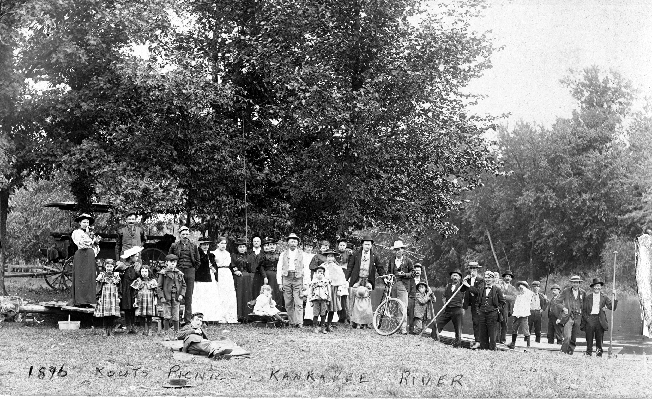
Baum’s Bridge picnic
There has been proposed a movement to establish a few acres around Baum’s Bridge as a recreation area and park site, and the making of perhaps a dozen historical locations.
According to the History of Porter County compiled by Weston A Godspeed, from several previous histories, including Talcott’s, Reverend Ball’s, Herbert Skinners and David Sherwood’s, there are 62 places in the county that should be marked with a bronze tablet or plaque. Of these five have been so marked, the Old Sac Trail, the first schoolhouse, the ninth Regiment encampment, the Osborne grave, and the Tassinong site. At the Kankakee River Crossing known locally as Baum’s Bridge, where they’re a dozen important sites, a few amateurishly painted signs have been erected by historically minded residents over the past two or three generations, at some of these, but they should all be memorialized in bronze.
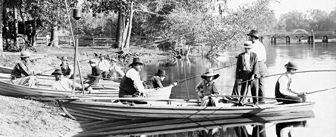
Fishing at Baum’s Bride
The Conservation Department has been advocating the setting aside a few acres there is a Riverside Park, with the main historical places well marked.
From Indian legends of 130 years ago, handed down by the first settlers, there’s a story that fits history perfectly, that Father Marquette, ”The Beloved Black Robe” preached to gatherings of Indians there when he was a student-missionary, learning the various Indian languages and engaging in” practice preaching” several years before he accompanied Joliet on the Mississippi River exploration.
Local inhabitants have put up a sign at the Jesuit preaching place, several times during the past. The site has always been the same, the spot pointed out to Mrs. Gille Ann Trinkle by the Indian women, in 1835. Historians will remember that Mrs. Trinkle never saw a white woman for the first two years of her life in Pleasant Township. Her feminine acquaintance was solely the Indian women that are about, and during those two years she learned the Pottawatomi language. Her association with these Indian women brought to her many of the ancient legends, and because of her reminiscences years later the “preaching place” was duly marked. Those public spirited citizens who have from time to time replace the weather worn and dim sign have constantly replaced it exactly in the original spot.
Then of course there is the undisputed place called La Salle’s Landing. It is across the river in Jasper County but it is that the Baum’s Bridge site. This too has been marked and remarked from time to time, by both county and state historians. Today it is almost at the same place it was located before the reclamation service disturbed it during the days of the ditching and draining. This also is the hand painted signboard, and should be replaced with a bronze tablet.
There is also larger metal marker at the approach of the bridge. This is a painted sheet iron sign, and which has been painted some fragmented history of the crossing since it was known as Sherwood’s Ferry and Eaton’s Bridge. This sign was a WPA project some 30 years ago, but has been repainted, somewhat poorly it must be confessed, from time to time as the letter is grew dim or chipped off.
There is also another marker there, only a painted sign, that shows where General Lew Wallace camped, or where he came ashore to enjoy a dinner at Wilcox’s boardinghouse once in awhile, when he grew tired of ”Old Ebony’s” cooking aboard the houseboat. It was due to the late Mrs. William Moorehouse, who as a young woman, waited on tables at Wilcox’s, and knew General Wallace, that this sign was originally erected shortly after Lew Wallace died in 1906. Each year for all those succeeding years, some kindly local person has restored that sign. Today it is still located exactly where Mrs. Moorehouse first nailed it to a tree.
In addition to these sites there are others needing a marker, the site of the old village of Mayfield, the old Indian cemetery in the northwest corner of section 25, the several once famed hunting lodges, the locations of the original Ojibwa Indian village in section 24, the ancient abattoir at the edge of the swamp in section 36, or for uncounted ages the Indians brought their game to skin it, cut it up, and divide, and where the ditching machines dug up thousands of discarded antlers, dating back over 500 years.
This also was the site of the old ford where for a hundred years French officials crossed the Kankakee is they traveled from or to Mackinaw and Vincennes, and old Cahokia, and Kaskaskia, and it was close by where the Indians once had a Council Ground and a hard packed dirt “dance floor” where even as late as the arrival of the first white settlers.
And also, if one wants to be thorough in the marking of interesting sites, there should be a marker showing where the skeletons of ancient prehistoric animals have been dug up by the great ditching machines. Bones of mastodons, giant beaver, and the saber tooth tiger, who roam this region when the temperature was once almost tropical in character.

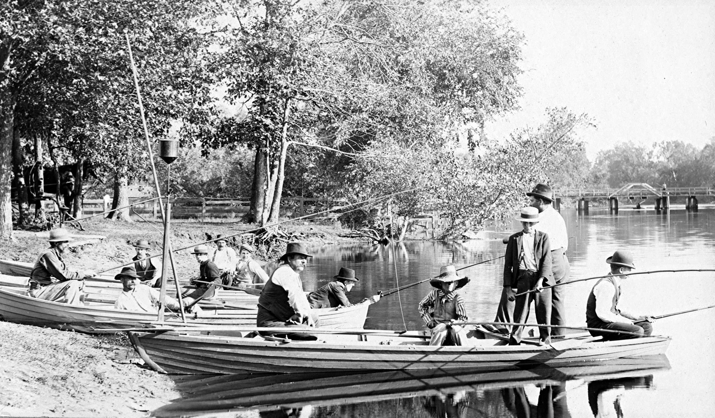
At Baum’s Bridge
This whole 10 acre area is replete with historical locations, and constitutes a large part of the 62 sites in Porter County that should eventually be marked. If this Kankakee River site can be set aside by the state it will be a highly valuable and frequently visited area where students, historians, and visitors in general can come and be able to say “I stood on the same ground where Father Marquette once preached” or “I have walked along the same mound where Father Hennepin said the La Salle party camped December 10, 1679. A party of eight canoes and 30 men.
“How much better can one teach history?” Asked a teacher, “Then by piloting one’s students to the actual ground where history was made.”
There could be a thick volume written about the history of the Kankakee at this place. It has been the best-known crossing of the Kankakee for many miles in either direction. It has presumably been used for a thousand years. It was the only all weather crossing for animals or mankind when the Kankakee River was mapped as the Siengelay, or The Kiki. Back in the days when Lake Michigan was called Las Illinoi by the French map makers, and when all the region south of the lower end of the lake was called “the Illinois Country” this fording place was the route to the Wabash Valley and all points south in what was then Louisiana.
After the French ”Evacuation Decree,” after the British took possession of Canada, the same fording place was used by the English soldiers coming to occupy all of Canada and much of the northern part of the continent. It was they who change the name of La Grand Marais to English Lake, and Tassinong on to Bengual, and La Petite Fort to Little Fort. It was they who destroyed the rammed earth fort along the river once occupied by a French garrison, and it was the same contingent of British soldiers that tried to wipe out and destroy everything French. And here was they necessarily came to cross the river.
Nearby is the place General Hull came in 1812, and where Lieutenant Swearingen and his body and soldier-woodsman came in 1803 in route to build Fort Dearborn.
By all means let’s set this ground aside as a park, for it is a site that will one day make Porter County famous, and will bring visitors from afar.
This old Indian fort, the site of Sherwood’s Ferry and Eaton’s Bridge and Baum’s Bridge, and the location of a very ancient Indian village. It’s not logical at these sites should remain anonymous and buried in the sands of time.